Click here to join Express Pune WhatsApp channel and get a curated list of our stories
© The Indian Express Pvt Ltd

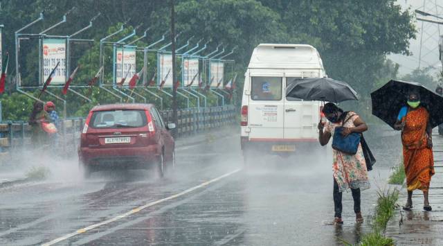 On the contrary, east and northeast India remained rain deficient at -6 per cent, -14 per cent and -15 per cent between July 13 and 28) after surplus rain in May and June. (PTI/File)
With two months of the Southwest monsoon nearing completion, the rainfall over the country as a whole has been fairly good. The number of rain deficient states fell from 18 in June to 7 on July 29. As on Friday, the all-India rainfall was 9 per cent above normal (since June 1).
However, what stood out about the monsoon this year is that the displayed large-scale variations, causing floods in Gujarat, Rajasthan and Maharashtra and extreme aridity over Uttar Pradesh, Bihar, West Bengal and Jharkhand.
The Southwest monsoon remained active through the first fortnight of July, wiping off all major deficiencies from over the peninsular region (except Kerala) and central India. These two regions have consistently remained rainfall-surplus all through July, states data available with the India Meteorological Department (IMD). As the rainfall activity improved, peninsular India recorded three weeks of rainfall between July 13 and 28, with the quantum measured at 34 per cent, 34 per cent and 30 per cent above normal. Likewise, central India, too, saw robust rainfall for three consecutive weeks at 25 per cent, 30 per cent and 25 per cent during the same period.
On the contrary, east and northeast India remained rain deficient at -6 per cent, -14 per cent and -15 per cent between July 13 and 28) after surplus rain in May and June. Rainfall over northwest India, however, improved from -10 per cent in mid July and -9 per cent in the third week to 2 per cent as on July 28.
On Friday, the monsoon trough shifted north of its normal position and is likely to remain at this position for the next four to five days. As a result, north India is likely to experience heavy rainfall till the middle of next week, the IMD’s latest forecast stated.
“Himachal Pradesh, Uttarakhand, Haryana and east Uttar Pradesh will receive widespread rainfall with heavy rainfall spells (64.5mm to 115.4mm in 24-hours) till August 2,” an IMD official said.
Uttar Pradesh, Bihar, West Bengal, Jharkhand and Kerala have not yet received normal rainfall this season. IMD officials put out a gloomy forecast for Uttar Pradesh, Bihar and Jharkhand saying that it was highly unlikely that these deficits will be covered in early August.
“Consistent and good rainfall spells will be required in August in order to minimise such high deficiencies,” Medha Khole, senior weather forecaster at IMD, Pune, said.
However, the IMD officials are more hopeful about prevailing deficits over Manipur (-36 per cent), Tripura (-29 per cent), West Bengal (-27 per cent) and Kerala (- 25 per cent) being covered in the coming days as these states would benefit from the spells forecast early next month.
According to the Met department, monsoon currents from the Arabian Sea will move towards Gujarat and Rajasthan over the next one week.
Overall, the monsoon currents continue to remain weak and will remain so till August 4.