Journalism of Courage
Premium
This is an archive article published on March 4, 2021
Study shows increase in overall mangrove forest cover by 48.79 sq km: Forest dept
The mangrove cell said the reduction in sparse mangrove cover depicted a big conversion of sparse to dense mangrove. "Total increase in mangrove forest is found to be 48.79 sq km for all districts," read the report.

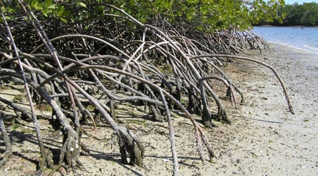 Since 2005, the state government has taken possession of 14323.29 hectare. (File)
MAHARASHTRA’S OVERALL mangrove cover has increased by 48.79 sq km, a study by the mangrove cell of the state forest department has shown. The forest cover in 2005 was 304.39 sq km.
Many mangrove patches in the state, especially in denser areas, are inaccessible by foot or boat. In 2018, the state mangrove cell approved a proposal from Indian Institute of Space Science and Technology (IISST) in Valiamala, Thiruvananthapuram (Kerala), to study mangrove cover in six coastal districts and also track the health of mangrove forests using real-time satellite remote sensing data.
Mangroves are a diverse group of salt-tolerant plant community of tropical and subtropical intertidal regions of the world. Many mangrove forests can be recognised by their dense tangle of prop roots that make the trees appear to be standing on stilts above water. Similar to forest cover, mangrove cover is also divided as “very dense”, “moderate” and “open”.
Mangroves in six districts — Thane, Palghar, Mumbai (suburban and city), Raigad, Ratnagiri and Sindhudurg — were mapped under the project. The study recorded a 100.35 sq km increase in dense mangrove (canopy density of 70 per cent and above) found between 2005 and 2018 while the extent of sparse mangrove (canopy density between 10 and 40 per cent) is reduced from 105.12 to 53.55 sq km.
The mangrove cell said the reduction in sparse mangrove cover depicted a big conversion of sparse to dense mangrove. “Total increase in mangrove forest is found to be 48.79 sq km for all districts,” read the report.
Among six districts, Sindhudurg recorded minimum increase (0.3 sq. km) while Mumbai and Raigad showed a substantial increase in mangrove cover of an additional 12.9 and 22.2 sq km, respectively. Of the six, only Palghar district recorded a reduction in mangrove cover, by 10.34 sq km.
Across the six districts, sparse mangrove cover reduced. “About 44.25 sq km of sparse mangrove is converted to dense mangrove, which is considered to be a positive change, and 16.17 sq km of dense mangrove changed to sparse indicating degrading stage,” read the report.
Story continues below this ad
In the second phase of the project, a mobile application is being prepared for real-time updates from the field. Satellite images will be relayed to the forest department every month in the form of reports to check area-wise increase, destruction cases and areas where restoration can be done.
Virendra Tiwari, additional principal chief conservator of forest (mangrove cell), said, “The mobile application is expected to be functional soon.”
The IISST is also preparing maps indicating the health of mangrove forests that will be developed, including mangrove density, fragmentation, diversity, vegetation indices, erosion or accretion status, drainage density, sedimentation and blockages, along with river or estuary courses.
Mangrove forests stabilise coastline, reducing erosion from storm surges, currents, waves and tides. The intricate root system of mangroves also makes these forests attractive to fish and other organisms seeking food and shelter from predators.
Advertisement
Loading Taboola...

Live Blog
Top Stories


Advertisement