Journalism of Courage
Premium
Why Mumbai’s temperature is fluctuating like a yo-yo
Several weather experts have attributed the rapid rise in temperatures last week to the influx of easterlies and the after-effects of Cyclone Fengal.

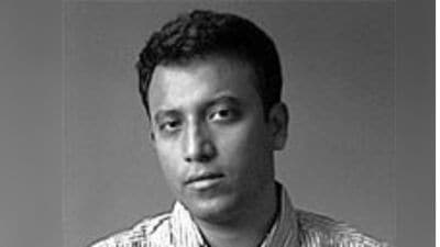
 Misty-Smoggy morning near Gateway of India on Friday. (Express Photo by Amit Chakravarty)
After waking up to its coldest December day since 2015 on Monday, Mumbai’s minimum temperature soared by nearly 6 degrees Celsius within two days as the city recorded 20 degrees Celsius on Wednesday.
Over the past few weeks, Mumbai has been experiencing rapid fluctuations in temperatures in maximum as well as minimum temperatures, leaving people to grapple with extreme heat and cold within a short period of time.
Earlier this week, for instance, the India Meteorological Department (IMD)’s Santacruz observatory recorded 13.7 degrees Celsius on Monday in what made it the city’s coldest December day since 2015. This drop in temperature came barely five days after citizens sweltered under a maximum temperature of 37.3 degrees Celsius on December 4, making it the city’s hottest December day since 2008. Yet again, the record-shattering heat levels were recorded a week after Mumbai’s minimum temperature dropped to 16.8 degrees Celsius on November 26, which itself was the coldest November day of the city in the past eight years.
What is causing these rapid fluctuations?
Several weather experts have attributed the rapid rise in temperatures last week to the influx of easterlies and the after-effects of Cyclone Fengal.
“Earlier, we saw a spike in Mumbai’s temperatures due to Cyclone Fengal. During the cold spell, meanwhile, the winds have not been steady. For instance, when the temperature dropped to 13.7 degrees Celsius, the city received strong northerlies due to snowfall in the northern belt. However, these winds didn’t stick around for long,” said independent weather forecaster Athreya Shetty.
According to meteorologists, Mumbai is prone to such waves of rise and drop in temperatures during winter until January.
IMD director Sunil Kamble told The Indian Express, “Whenever there is a western disturbance i.e. snowfall in the northern region, the northerly winds gush in and result in drop in temperatures. But if there is any other system which leads to moisture incursion, temperature shoots. This is a common cycle that Mumbai experiences during winters as the city is dependent on the northerlies and easterlies for the drop in temperatures.”
Story continues below this ad
What explains the rise in temperatures this week?
Even as the remnants of Cyclone Fengal have waned, the city is yet again witnessing a spike in temperatures with the minimum temperature touching 20 degrees Celsius on Wednesday. Meanwhile, Colaba station registered 22.6 degrees Celsius.
In its forecast, the IMD has stated that the maximum temperature is likely to spike and oscillate between 34-35 degrees Celsius over the next few days. The minimum temperature is also expected to increase to 21-22 degrees Celsius — far higher than the 13.7 degrees Celsius the city recorded on Monday.
“Currently, we have another system in the Bay of Bengal which has resulted in moisture influx and, thereby, spiked temperatures,” Kamble explained.
When can the city expect its next cold spell?
After December 14, Mumbai may witness a dip in temperature, albeit a small one, weather experts have indicated.
Story continues below this ad
“The system over the South Bay of Bengal is expected to diffuse in the next three-four days. Currently, the easterlies have cut the effect of northerlies. But after December 14, we can expect a change in the wind direction, which is likely to result in drop in temperature,” said Mahesh Palawat from Skymet Weather Services.
Palawat added, “However, since there are no western disturbances (snowfall) on cards for now, the drop will not be significant.”
Advertisement
You May Like

Live Blog
Top Stories


Advertisement