


Stay updated with the latest - Click here to follow us on Instagram
© The Indian Express Pvt Ltd
Tags:
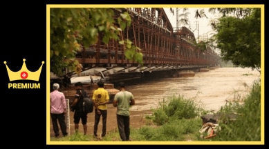
A dot that marks the Old Railway Bridge (ORB) near the Red Fort in Delhi, on a map on the Central Water Commission’s (CWC) website, went from yellow to orange to red in three days last week — indicating progressively rising water levels in the Yamuna over which the bridge is built.
The river breached the ‘danger’ level of 205.33 m on Monday evening, prompting the CWC to change the dot from yellow to orange. On Tuesday, the peak discharge from the Hathnikund Barrage upstream, in Haryana, stood at 3.59 lakh cusecs, against a normal discharge of around 352 cusecs.
On Wednesday, the dot went from orange to red, when the rising water crossed the Highest Flood Level (HFL), or the highest-ever level that the river has recorded at the bridge — 207.49 m. It remained red till Saturday morning, when the water had receded, after Delhi had seen its worst-ever recorded flood in 45 years.

The red dot marking the Old Railway Bridge stood out amidst a cluster of similar dots marking CWC monitoring stations upstream of the bridge along the Yamuna from the Hathnikund Barrage to Delhi — none had turned red. They remained green, yellow, or orange, indicating that the stations that lie between the barrage and the bridge had not breached the highest levels they had recorded in previous years. These were the stations of Kalanaur and Karnal in Haryana, Mawi and Baghpat in Uttar Pradesh, and Palla which is near the point where the river enters Delhi.
When asked if any other monitoring stations of the CWC between Hathnikund Barrage and the Old Railway Bridge had breached the HFL this past week, a senior official of the CWC, who asked not to be identified, said that they had not.
“It depends on the site. After Hathnikund, we have a station at Karnal for instance. Here, the site is very wide, and the Yamuna spreads out. Since there is very little habitation there, even the warning and danger levels are high, as the possibility of damage is low. In Delhi, the Yamuna is constricted,” the official said.

The ‘warning’ and ‘danger’ levels are determined based on threat perception, in consultation with the state government, the official explained. “The ‘warning’ and ‘danger’ levels should ideally be reviewed and updated periodically,” the official added.
Bhim Singh Rawat, associate coordinator of the South Asia Network on Dams, Rivers and People, said, “The rise in water level at these other stations had not crossed their HFLs. At the Old Railway Bridge, the HFL was breached by over one metre. There could be many reasons — floodplain encroachments, multiple structures, concretisation. The gates of the ITO Barrage being closed would have also blocked the free-flowing water, and how much that has contributed to raising the water level would have to be assessed.”
As the situation starts to improve in the city, officials said answers will be found only after a multi-department assessment.
“Flooding at this scale is unusual in Delhi. Usually, it will first hit areas that lie upstream in Haryana. This time, however, the water level rose quickly and the breach in the regulator near ITO made matters worse. Simply put, no one was ready for this. The Irrigation and Flood Control Department of the Delhi government is small and not the most well-prepared since such a situation is rare,” said a senior Delhi government official who did not want to be named.
One of the answers may lie in the way the Yamuna flows through the region. In upstream Haryana, the floodplains are mostly unencumbered. Even when it enters Delhi near Palla, a wide floodplain is available for the Yamuna to spread across. It is near Wazirabad that the river becomes jacketed between embankments and can only rise vertically.
“Unless there is a very big quantity of water, the high embankments will not be easily breached and the river will rise vertically. We have seen that the water released by Haryana in 2013 and 2019 was far more than what it was this year. It is perplexing that the levels in Delhi rose to an all-time high despite this. It points towards some sort of an obstruction. The government has said that five of the 32 gates at the ITO Barrage were not open. It needs to be studied whether these five gates will have such a high impact. For this, one also has to see which areas were flooded. If there is no flooding upstream, there might be an obstruction in the river in Delhi which is allowing the water to accumulate,” said Manu Bhatnagar, Principal Director of INTACH’s Natural Heritage Division.
On Saturday, the water level at the ORB had receded to 206.54 m at 11 pm and discharge from Hathnikund had fallen to around 39,000 cusecs at 1 pm.
An official of the Irrigation and Flood Control Department, said that when the discharge from the barrage was higher earlier, like the roughly 8 lakh cusecs released in 2019, the river upstream may have possibly breached its embankments significantly, which could have reduced the flow downstream.
“There might be many factors contributing to an increase in the water level in the Delhi stretch. The flood-carrying capacity of the floodplain is drastically reduced. The floodplain is as narrow as 300 m in a few stretches,” said ecologist CR Babu, who is a member of the Principal Committee constituted on the orders of the National Green Tribunal (NGT) to monitor the rejuvenation of the Yamuna. The committee’s approval is required before any work is taken up on the floodplains.
“The width of the floodplain at Palla is wide. I’ve seen it. The floodplain there is mostly under agriculture, except for a village a few kilometres away from the river, which has a bund. From Wazirabad downstream, the floodplain is compromised… Even dumping of waste on the floodplain can provide resistance to flood water. Each bridge, each pillar, will contribute to the extent of rise in water levels during a flood. Separate bunds were created to protect the Common-wealth Games Village and Akshardham, and each bund will create resistance. If the floodplain used to be 5 km and has been reduced to 300 m, where will the water go? It’s not just the river water. If the major drains are blocked or encroached, there will be backflow of sewage as well,” Babu said.
Babu added: “Why has this not happened earlier? Our floodplain has shrunken drastically, and we didn’t have so many bunds. The floodplains used to have many catchment wetlands, which have been filled up. So, even if we have a smaller discharge (from Hathnikund), there is a rise in water level.”
Several experts have advocated for dredging and desilting the river, which officials say is only a few feet deep at many places. But the response has been lukewarm. The landmark NGT order about cleaning the Yamuna, in 2015, said the idea could be explored but cautioned against over exploitation for sand mining.
According to Babu, however, rivers are a self-regulating system. “Even at a medium flood level, which occurs in the monsoon, the sediment is flushed out. These are ecological processes that sustain the river,” he said.
While the HFL was recorded in 1978 in Delhi, the flood in 1997 caused more damage, data from the CWC indicates. A total of 18 lives were lost in the 1978 floods, while 52 lives were lost in 1997, according to the CWC’s report on flood damage statistics from 1953 to 2020. In 1997, 66,739 houses were damaged, against 10,670 in 1978. The cattle lost was 339 in 1978, and 660 in 1997.
Stay updated with the latest - Click here to follow us on Instagram

