


© IE Online Media Services Pvt Ltd
Tags:
After making landfall in Florida on Wednesday, Hurricane Ian left a trail of destruction in its aftermath. With a wind speed of 150 mph (241 kph), the category four hurricane has become one of the strongest hurricanes to hit the US.
On Thursday, the National Aeronautics and Space Administration (NASA) posted a clip that documented what Hurricane Ian looked like from space.
While sharing a video of the swirling high-speed winds, NASA wrote, “Hurricane Ian as seen from the International Space Station (@ISS) on Sept. 28, 2022, as it orbited 258 miles (415 km) above.”
The space agency further added, “The vantage point of space, and our fleet of more than 20 Earth-observing satellites, help us provide insights and updates on hurricanes, and other extreme weather events. We collaborate with the National Oceanic Atmospheric Administration (@NOAA), and design, build and launch some of the satellites that provide data that feed numerical weather prediction models. The video captures Hurricane Ian as it makes landfall in Florida earlier this afternoon at 3 p.m. ET.
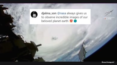
“The post gathered over 6.5 lakh likes. Commenting on it, an Instagram user wrote, “@nasa always gives us to observe incredible images of our beloved planet earth.” Another person remarked, “Imagine skydiving into it.”
In 2019, astronaut Luca Parmitano shared a photo of hurricane Dorian, one of the most powerful Atlantic storms on record, that was taken from the International Space Station. The viral image gave a close look at the storm’s eye.

