


© The Indian Express Pvt Ltd
Tags:
Scientists have detected a lost Mayan city, hidden for centuries by the dense Mexican jungle, using LiDAR.
LiDAR, or Light Detection and Ranging, is a remote sensing technology that uses light in the form of a pulsed laser to measure ranges (or variable distances) of a sensor, usually mounted aboard an aircraft, to Earth’s surface. LiDAR data can be used to create high-resolution 3-D models of ground elevation with a vertical accuracy of upto 10 cm, according to the US Geological Survey.
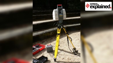
LiDAR instrumentation comprises a laser, a scanner, and a GPS receiver. The rapidly firing laser travels to the ground where it hits vegetation, building, and various topographic features. This light is reflected or scattered, and recorded by the LiDAR sensor.
The system calculates the light pulses’ two-way travel time to arrive at the distance between the terrain and the sensor. It processes this information with Global Positioning System (GPS) and Inertial Measurement System (IMS) data, to create an elevation map of Earth.
LiDAR data is initially collected as a “point cloud” of all individual points reflected from everything on the surface, including structures and vegetation. But the specifics of how much light energy was returned to the sensor allows further identification of different features, such as vegetation, buildings, etc. For example, tree canopies, however dense they may be, allow some light to pass through and hit the ground.
The LiDAR data can be further refined to produce what scientists call a “bare earth” Digital Elevation Model, in which structures and vegetation are stripped away.
LiDAR is used to generate precise, three-dimensional information about the shape of the Earth and its surface characteristics. This is obviously very useful information for geographers, policy makers, conservationists, and engineers. In recent years, however, LiDAR has also shown potential as a tool of archaeological discovery.
“For the longest time, our sample of the Maya civilisation was a couple of hundred square kilometres total,” Luke Auld-Thomas, the lead author of the latest research published in the journal Antiquity, said in a press release. “That sample was hard won by archaeologists who painstakingly walked over every square metre, hacking away at the vegetation with machetes, to see if they were standing on a pile of rocks that might have been someone’s home 1,500 years ago,” he said.
But LiDAR allows researchers to study much larger swathes of land quickly in the comfort of a home or lab. Auld-Thomas used publicly available LiDAR data taken for a forest monitoring project in 2013 to discover the city he named Valeriana in Mexico’s Campeche region.
The city “has all the hallmarks of a Classic Maya political capital: multiple enclosed plazas connected by a broad causeway, temple pyramids, a ballcourt, a reservoir formed by damming an arroyo (a seasonal watercourse), and a probable … architectural arrangement that generally indicates a founding date prior to 150 CE”.
He hopes that his chance discovery will help uncover further hidden settlements of the civilisation. He said: “We found a large city with pyramids right next to the area’s only highway, near a town where people have been actively farming among the ruins for years. The government never knew about it, the scientific community never knew about it… there’s a lot more to be discovered.”


