


Stay updated with the latest - Click here to follow us on Instagram
© IE Online Media Services Pvt Ltd
Tags:
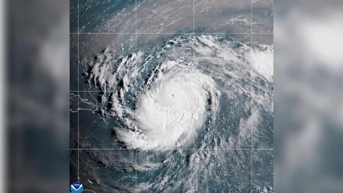
Hurricane Erin, the first major storm of the 2025 Atlantic season, has stunned forecasters by intensifying at a pace rarely seen in recorded history. In just over 24 hours, the system leapt from a Category 1 hurricane with 75 mile-per-hour winds to a Category 5 with near-160 mile-per-hour winds, according to the National Hurricane Center. Meteorologists say that rate of intensification ranks among the fastest ever observed in the Atlantic, and possibly the quickest before September.
On Monday, Erin was located nearly 1,555 km south-southeast of Cape Hatteras, North Carolina. According to BBC, its tropical storm-force winds extended out 230 miles from the center, making it a sprawling storm system that forecasters expect could double or even triple in size over the next few days.


“It explosively deepened and intensified,” NHC director Mike Brennan said, noting how the storm “barrelled toward the Caribbean” before slowing and expanding in size.
Hurricane Erin is not expected to make landfall in the United States. The storm is currently passing north of Puerto Rico and the Dominican Republic, with tropical storm warnings in place for Turks and Caicos islands. Rainfall of up to 15 cm has been forecast, raising the risk of flash floods and landslides.
On its current track, Erin is forecast to veer north of Puerto Rico, then curving north-northeast into the open Atlantic between the East Coast and Bermuda.
Even without reaching land, Hurricane Erin will bring hazards to coastal communities, forecasters say. Dangerous surf and rip currents will begin affecting southern US beaches on Monday, spreading to Florida and mid-Atlantic states later in the week, he added. Bermuda and the Bahamas are also expected to see heavy rainfall and hazardous swells.

Because of gale-force winds, the US Coast Guard has restricted vessel movements at ports on St Thomas and St John in the US Virgin Islands, as well as six municipalities in Puerto Rico, including San Juan, reported BBC.
Dare County in North Carolina, where the Outer Banks are located, had issued a local state of emergency, which included a mandatory evacuation order for Hatteras Island.
The National Oceanic and Atmospheric Administration (NOAA) has predicted an “above normal” Atlantic hurricane season this year. Scientists warn that climate change is fueling frequent and more intense storms, with Category 4 and 5 hurricanes forming at a faster pace.


Stay updated with the latest - Click here to follow us on Instagram

