


© The Indian Express Pvt Ltd
Tags:
Tropical cyclone Michaung will cross the Andhra Pradesh coast in Bapatla district between the cities of Nellore and Machilipatnam in the forenoon of Tuesday (December 5), the India Meteorological Department (IMD) said on Monday (December 4) evening.
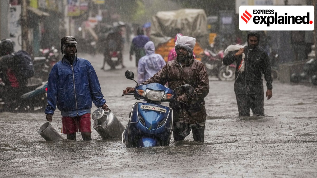
The storm, which was centred around 80 km southeast of Nellore and 120 km north-northeast of Chennai at 5.30 pm on Monday and moving northward along the Andhra Pradesh coast, has brought heavy rain to most of Tamil Nadu, parts of Andhra Pradesh, and southern Odisha.
An unusual cyclone
Due to unfavourable ocean conditions, storms that develop over the North Indian Ocean in December don’t usually attain destructive intensities. High-intensity cyclones — packing high speeds and bringing heavy and widespread rain — such as Michaung are not common at this time of the year.
The IMD had initially predicted that Michaung would remain a ‘tropical cyclone’ (wind speeds of 62 kph to 87 kph) until it crossed the Andhra Pradesh coast. On Sunday, however, the IMD upgraded it to the intensity of a ‘severe’ storm (wind speeds of 88 kph to 166 kph).
Such intensification of a December cyclone is unique, the IMD said. The above-normal value of the heat index off the southern Andhra Pradesh coast led to the strengthening of Michaung, IMD officials said.
Indian tropical storms
Climatologically, about five cyclones develop in the North Indian Ocean basin — comprising the Bay of Bengal and the Arabian Sea — every year. Of these, an average of four cyclones develop over the Bay of Bengal and one over the Arabian Sea. However, Arabian Sea storms often reach higher intensities and carry the potential to cause widespread damage.
The North Indian Ocean basin is most prone to cyclone development during the pre-monsoon (April-June) and post-monsoon (October-December) months. Due to favourable ocean conditions, cyclones that form in May and November usually reach higher intensities than storms that form at other times.
Storm intensification
Tropical cyclones are fueled by ocean heat (in addition to other factors). Ocean temperatures of 26 degrees Celsius or more, prevailing at depths between 50 metres and 100 metres, are conducive for cyclogenesis, which refers to the processes that lead to the development and strengthening of a cyclone.
Warm oceans contribute to a cyclone’s rapid intensification while at sea. An oceanographic parameter called the Tropical Cyclone Heat Potential (TCHP) is considered an important factor in cyclone genesis, intensification, and propagation.
The intensification process is highly complex, and is also influenced by a combination of various favourable atmospheric conditions including boundary layers (the fluid layer adjacent to a bounding surface), wind shear (changes in wind direction and/or speed over a vertical or horizontal distance), convection (transfer of heat within a fluid), Rossby waves (which occur in rotating fluids), upper ocean circulation, and air-sea interaction.
What after landfall
The IMD has warned of very heavy to extremely heavy rain (115 mm to 200 mm and above) over the Godavari, Krishna, Bapatla, Guntur, Srikakulam, Palnadu, Dr B R Ambedkar Konaseema, Yanam, Kakinada, Anakapalli, Visakhapatnam, Vizianagaram, Kurnool, and YSR districts of Andhra Pradesh on Tuesday and Wednesday.
It is expected to cause widespread crop damage. Paddy, pineapple, and other standing crops that are nearing harvest, could be hit due to the extremely heavy rainfall (over 200 mm in 24 hours) during the next two days.
Storm surges and tidal waves up to 1.5 metres are predicted as the cyclone nears the coast. Strong winds with speeds of 90-100 kph gusting to 110 kph, are expected during landfall. The IMD’s flash flood alert has warned of likely inundation in the low lying areas of Rayalaseema, Yanam, coastal Andhra Pradesh and Karaikal.
After crossing the Andhra coast, the system is expected to continue to move northwestward towards southern Odisha. Here, the IMD has issued an ‘orange’ alert.
(Anjali Marar works at Raman Research Institute, Bengaluru)

