


© IE Online Media Services Pvt Ltd
Tags:

For those of you wondering if Chennai floods is the result of a natural calamity driven by the el Nino or a manmade disaster that could have been avoided, here is something to ponder over. The satellite images of Chennai captured between 1984 and 2012 show how the city has change, maybe for the the worse.
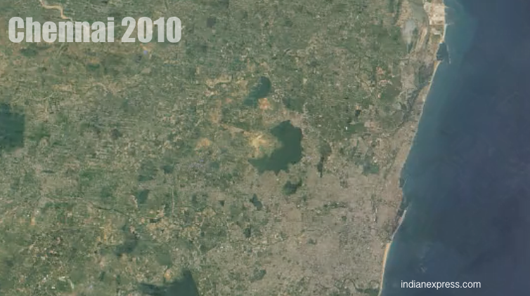
As the video from the Google Time-lapse project moves through the years, you see the city move from a green Madras to a brown and dry Chennai. Also, visible is how the small water bodies that do the city become invisible over time.

According to an explained story by Arun Janardhanan in The Indian Express dated December 3, 2015, “Across Chennai, illegal construction has been making neighbourhoods unrecognisable — what may have been a tank, lake, canal or river 20 years ago, is today the site of multistorey residential and industrial structures. There are over 1.5 lakh illegal structures in the city, according to a report submitted by CMDA to the Madras High Court.
Chennai rains special: See our video on Why Chennai is Flooded

Also see Crisis Map of flooded areas in Chennai


