


Stay updated with the latest - Click here to follow us on Instagram
© IE Online Media Services Pvt Ltd
Tags:

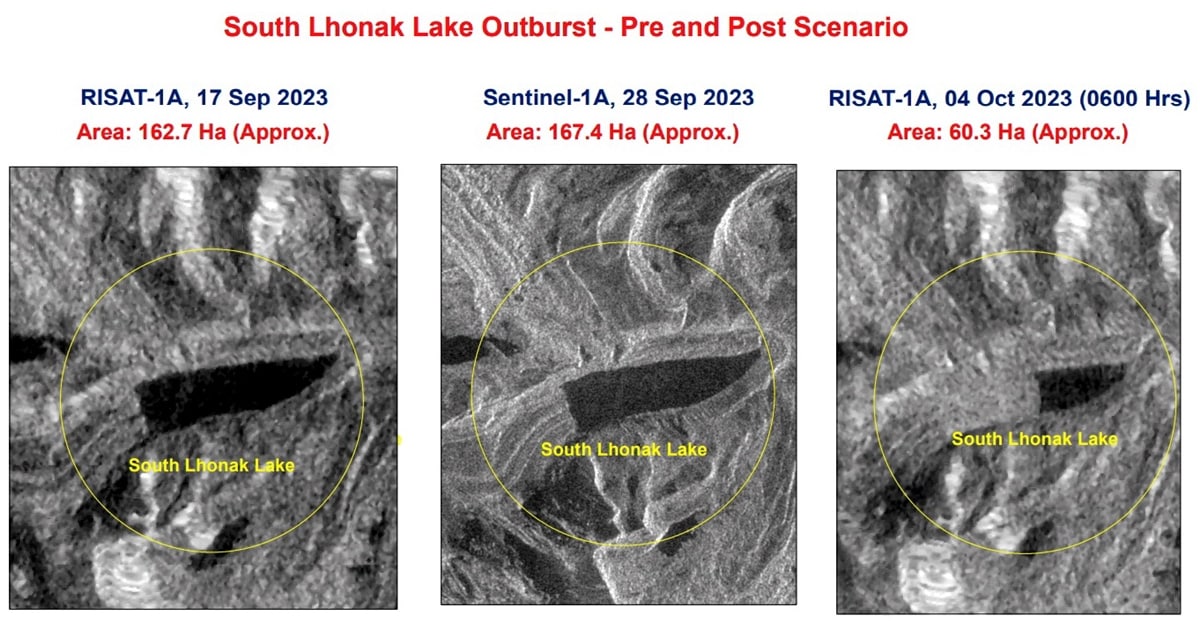
Around 105 hectares (1.05 sq km) of South Lhonak Lake in Sikkim was drained out after a cloudburst that triggered flash floods on Wednesday, the Indian Space Research Organisation (ISRO) has observed with satellite imagery. “It is observed that Lake is Burst and about 105 hectares area has been drained out (28 September 2023 image versus 04 October 2023) which might have created a flash flood downstream,” an ISRO statement said.
ISRO compared images of the South Lhonak Lake taken on September 28 (before it burst) and October 4 at 6 am (after the burst). The images were captured by the RISAT-1 (ISRO’s Radar imaging satellite) and Sentinel-1A (European radar imaging satellite). On September 28, the lake covered an approximate area of 167.4 hectares (1.674 sq km) and on October 4, after the glacial lake outburst, it covered 60.3 hectares (0.603 sq km).

The glacial lake outburst flood was triggered by heavy rainfall in the region. According to a PTI report, officials at the Central Water Commission are also exploring whether the earthquake in Nepal on October 3 may have caused the lake to burst.
As of Thursday morning, as many as 14 people had been killed due to the flash floods, and over 100 remained missing. Of those missing, 22 were Army personnel — one was rescued on Wednesday night.
The India Meteorological Department (IMD) has predicted heavy to very heavy rainfall over Sikkim and parts of West Bengal over the next two days.
Stay updated with the latest - Click here to follow us on Instagram

