Stay updated with the latest - Click here to follow us on Instagram
IMD predicts low pressure system over Bay of Bengal to intensify into Cyclone Asani tomorrow
There have been only eight cyclonic disturbances in March in the North Indian Ocean region between 1891 and 2021.

The low-pressure system brewing in South East Bay of Bengal and the adjoining Andaman Sea is likely to intensify into a depression today (March 20) and lead to the first cyclone in March since 2000 in the North Indian Ocean region on Monday. And if that happens, the cyclonic storm will be called Asani, the name given by Sri Lanka.
According to the India Meteorological Department (IMD), the system is predicted to move north-eastwards and reach near the north Myanmar and southeast Bangladesh coasts on March 22. The IMD has also predicted heavy to very heavy rainfall in a few places over the Andaman and Nicobar Islands with isolated extremely heavy rainfall likely over the Nicobar Islands.
monthly limit of free stories.
with an Express account.
Speaking to The Indian Express, Dr Mrutyunjay Mohapatra, IMD’s Director General, had said: “Cyclones in March in the North Indian Ocean may be few but are not rare… In the month of March, we do not get many intense systems. The maximum intensity it may go up to is that of a cyclone with wind speeds ranging between 70-80 km/ hr.”
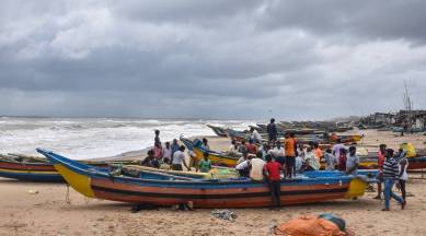
Heavy to very heavy rainfall (64.5mm to 204.4mm in 24 hours) is forecast over the Andaman and Nicobar Islands till Tuesday. And rough sea conditions, due to squally winds with speeds ranging between 55 and 65 km/hr reaching 75 km/hr, are likely to be recorded close to the Andaman and Nicobar Islands, southeast Bay of Bengal and the Andaman Sea. Fishermen have been warned from venturing into the deep sea till Tuesday.
There have been only eight cyclonic disturbances in March in the North Indian Ocean region between 1891 and 2021. According to IMD’s cyclone atlas maintained for this period, a majority were cyclonic disturbances –1907, 1924, 1925, 1928, 1938, 1994, 2000 and 2018 — which remained as depressions either formed in the Bay of Bengal or the Arabian Sea.