


Stay updated with the latest - Click here to follow us on Instagram
© The Indian Express Pvt Ltd
Tags:
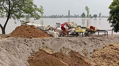
Monsoon floods in Punjab last year left a trail of devastation, yet it turned out to be a silver lining as far as the sand mining in the state is concerned.
An IIT-Ropar study report on river sand replenishment in Punjab reveals that the area under sand deposits has increased two-and-a-half fold — 2,093 hectares in the pre-monsoon period to 5,312 hectares post-monsoon — in the state.
The report suggests the volume of sand also saw a corresponding increase — 4.18 crore cubic metres during pre-monsoon to 10.62 crore cubic metres post-monsoon. The volume was calculated by considering a two-metre depth as an average, with depths varying from 1.5 metres to 2.5 metres at surveyed locations. The report, however, pointed out, “These are not the actual depths as some sediment is already present at the survey sites. Thus, the depth can be more at places that can only be analysed by taking the core samples, which was not in the scope of the study.”
“From the UAV (unmanned aerial vehicle) survey, we have found a very good correlation between the UAV survey area pre-monsoon and the post-monsoon sand area (more than 95%).
The UAV survey also provided the average depth of the sand bars to be around 2 metres, which can be taken as a minimum mining depth for the next year at all sites,” reads the report accessed by The Indian Express.
The report assumes significance with a government functionary telling The Indian Express that “so far mining has been mostly allowed up to a depth of around three feet or one metre”. “Backed by the IIT-Ropar report, the state government is likely to seek the clearance for sand mining up to two metres from the State Environment Impact Assessment Authority (SEIAA),” the functionary said.
If the government gets the go-ahead, it could be a win-win situation for all.
“If the mining is allowed up to two metres, it will double the royalty the government has been getting from the contractors. In the past, at times, contractors would mine deeper than the permissible limit and there were penalties for the same. But, if the depth is increased to two metres, it will help do away with illegal mining,” the functionary said.
“Given the massive deposition of sand and its availability in abundance, the sand prices will also come down,” the functionary said.
The report points out the actual volume deposited post-monsoon will be more than what has been recorded during the study, as it did not include the depth below the water level (through areas from the river bed) where new deposits formed after monsoon.
Dr Reet Kamal Tiwari, assistant professor at the Civil Engineering Department, IIT-Ropar, who jointly authored the report with assistant professor Dr Sayantan Ganguly of the Water Resources group of the department, told The Indian Express, “For the first time, a comparative study on pre-monsoon and post-monsoon deposits of sand has been conducted. Such studies should be conducted every year. It needs to be taken further to analyse site-wise depth of the available sand to help determine how deep sand can be quarried at a particular site.”
The report says there is a decrease in the number of mining sites from 650 in the pre-monsoon period to 564 post-monsoon, and attributes the decrease in such sites and increase in the area and volume of total sand to “high sedimentation rate”. “Due to the high sedimentation rate, it has been observed from the analysis of the satellite data that several small sand bars merged and formed larger sand deposits. This led to a decrease in the number of sites from 650 in pre-monsoon period to 564 post-monsoon,” it notes.
During the study, a “substantial number of sample points which significantly received replenishment and deposition” were surveyed to conclude the replenishment rate. It is based on field data in the form of a UAV survey; soil and water samples which were further analysed in the lab; satellite data; and empirical equations-based study.
The study recommends: “Satellite data-based study must be conducted every year to understand sediment transport. The river water flow velocity should also be studied at a regular interval using sensors to help model sediment deposits.
“The time of the UAV survey should be planned in such a way that all mining sites could be surveyed well in time, i.e., before the river rises.”
It further recommends, “A bathymetric survey [to measure the depth and underwater features of a waterbody] should be conducted at all mining sites at a regular interval so that the bed topography can also be included with the UAV (unmanned aerial vehicle) DEM (digital elevation method) to assess the exact amount of sand deposits.”
“The pivotal importance of the study is not a mere theoretical assertion, it is a resonant call to action resonating through the echelons of policy, regulation, and sustainable sand mining practices,” reads the report.
Stay updated with the latest - Click here to follow us on Instagram

