
Explained: When Junagadh voted to join India, and Pakistan got just 91 votes
Pakistan unveiled a new political map that includes Junagadh, in coastal Gujarat, whose decision to join India in 1947, formalised through a Plebiscite in 1948, was not accepted by Pakistan then.
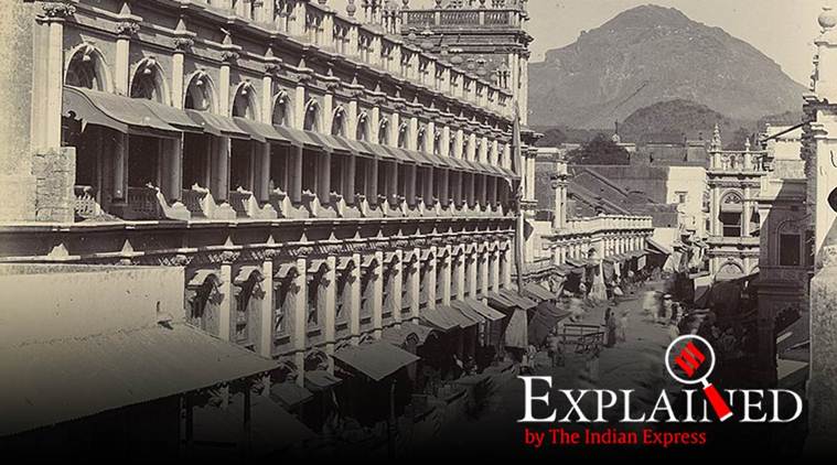 A bazaar at Junagadh in Gujarat. Photo by F. Nelson/1890/British Library via WikiMedia Commons.
Pakistan Prime Minister Imran Khan Tuesday unveiled a new political map that includes all of Jammu & Kashmir, Ladakh, Sir Creek and Junagadh. Khan and Pakistan Foreign Minister Shah Mahmood Qureshi have said this would be the new map of Pakistan.
Released a day before the first anniversary of the the BJP-led NDA government’s August 5 decisions rolling back special status of J&K and the bifurcation of the state into two, “it was the first time”, said Foreign Minister Shah Mahmood Qureshi in reference to the inclusion of J&K and Ladakh, “that a map reflected the aspirations of the people”. The federal cabinet, the Kashmiri leadership and Pakistan’s political leadership has endorsed the government’s move, he added.

India has dismissed the map as an “exercise in absurdity” that made “untenable claims” to territories in India. “These ridiculous assertions have neither legal validity nor international credibility, ” a statement from the Ministry of External Affairs said. The statement added that the release of the new map confirms Pakistan’s “obsession with territorial aggrandizement” supported by cross-border terrorism.
Pakistan’s inclusion of J&K and Ladakh appears to be a tit-for-tat for India’s inclusion of Pakistan Occupied Kashmir as part of the union territory of Jammu & Kashmir, and of Gilgit Baltistan as part of Ladakh in the new map the government released on November 2 after the re-organisation of J&K came into effect on October 31 last year.
However, two other inclusions have caused surprise. One is Sir Creek on the Kutch coastline, a 96-km estuary on the India-Pakistan through Gujarat and Sindh, on which India and Pakistan had nearly reached agreement in 2007-08, and which was once seen as “low hanging fruit” for bilateral resolution. Pakistan claims the entire width of the estuary, while India says the demarcation should be in the middle. Those who were part of negotiations say the entire disagreement has revolved around the size of the nib used to demarcate the estuary in an old map. The agreement, whenever it happens, will determine the Exclusive Economic Zone of both countries from where the estuary opens out into the Arabian Sea.
The other inclusion is that of Junagadh, also in coastal Gujarat, whose decision to join India in 1947, formalised through a Plebiscite in 1948, was not accepted by Pakistan then, but was overtaken by the first India-Pakistan war over Kashmir that began at the end of October 1947 and continued for over a year.
Jungadh was mentioned by Pakistan when the Security Council took up the issue of the hostilities in J&K in January 1948. Under the UN Security Council resolution 39, a commission was set up for the “peaceful resolution of the Kashmir conflict”, and the mandate of this commission was to investigate allegations by India of the situation in J&K, as well as “other issues” raised by Pakistan, which included Junagadh that Pakistan accused India of “annexing and occupying by force”.
But after the initial resistance from Pakistan, Junagadh has been seen as a settled matter in the bilateral relationship, brought up sometimes in conversations in Pakistan by those wishing to make the point that when India could not countenance the accession of a Hindu-majority state with a Muslim ruler to Pakistan, it should have applied the same yardstick in Kashmir and accepted Pakistan’s claim on a Muslim-majority state with a Hindu ruler.
Exactly the inverse argument has been presented by Indian scholars and historians. Rajmohan Gandhi has written how India’s first home minister, Sardar Vallabhai Patel, who was in charge of integrating the newly independent India’s provinces and the princely states in one union, had absolutely no objection to let Kashmir join Pakistan, but changed his mind on September 13, 1947, the day Pakistan accepted Junagadh’s accession.
“If (Muhammad Ali) Jinnah could take hold of a Hindu-majority State with a Muslim ruler (Junagadh), why should the Sardar not be interested in a Muslim-majority State, with a Hindu ruler (Kashmir)? From that day Junagadh and Kashmir, the pawn and the Queen, became his simultaneous concerns,” Gandhi wrote in his biography of Patel (Patel: A Life, 1991). For Patel, the King was Hyderabad, an exact mirror of Junagadh – Muslim ruler, Hindu subjects. “Had Jinnah allowed the King and the pawn to go to India, Patel, as we have seen, might have let the Queen go to Pakistan, but Jinnah rejected the deal,” Gandhi wrote.
📣 Express Explained is now on Telegram. Click here to join our channel (@ieexplained) and stay updated with the latest
Junagadh’s accession to India
Junagadh was in the Kathiawar region, where most other princely states had already acceded to India. The ruler of Junagadh was Nawab Mahabatkhan Rasulkhanji, who V P Menon, Secretary in the Ministry of States under Patel, described in his book ‘The Story of Integration of the Indian States (1956)’ as “an eccentric of rare vintage”. The state was not contiguous with Pakistan. Eighty per cent of the population was Hindu. Somnath, where the famous Shiva temple was ransacked by Mahmud Ghazni, is located in Junagadh, near the port of Veraval.
In May 1947, the Dewan-ship of the state changed hands through palace intrigue to a Muslim Leaguer from Karachi, Shah Nawaz Bhutto (his son Zulfikar Ali Bhutto would become the Prime Minister of Pakistan). Under his influence, the Nawab decided to accede to Pakistan on August 15, though he had earlier given the impression that the future of his Kathiawari state lay in joining India.
“Junagadh was an economic and administrative unit embedded in and deriving its sustenance from Kathiawar. Its detachment would turn it into a hothouse plant with no powers of survival. What worried me most were the immediate potentialities for turmoil when stability was the crying need of the hour. The Nawab’s action would have undesirable effects on law and order in Kathiawar as a whole. It would extend the communal trouble to areas where at present there was peace. There was also the fear that it would encourage the intractable elements in Hyderabad,” Menon wrote.
After failing over a month to get a response from Pakistan to an offer by Nehru “to accept and abide by the verdict of the people of Junagadh in respect of the accession of the State to either of the Dominions”, starting from the last week of September to the end of October, India put in place a series of measures that held the threat of military action against Junagadh, mainly by deploying troops around the state, in an effective blockade. The Nawab of Junagadh fled to Karachi by air, with his family, his favourite dogs and valuables. According to Menon, he took all the cash balance of the state and all the shares and securities in the Treasury.
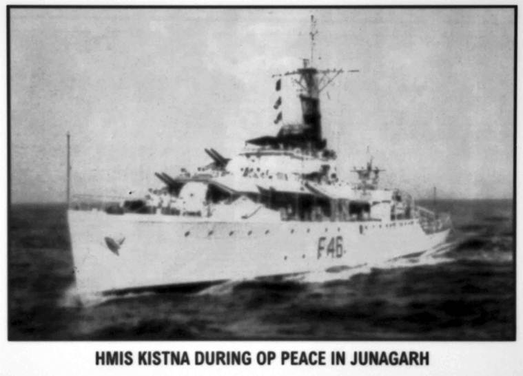 HMIS Kistna during OP peace in Junagarh
On October 27, Bhutto wrote to Jinnah about the precarious situation in Junagadh – no money, no food, and even the Muslims of Kathiawar were not interested in the promise that Junagadh’s accession to Pakistan had initially held: “…The situation has therefore so worsened that responsible Muslims and others have come to press me to seek a solution of the impasse. I do not wish to say much more. … The question is delicate but I feel it must be settled honourably to the satisfaction of all. It is impossible for me to court any further bloodshed, hardship and persecution of loyal people.”
In September, a parallel government of Junagadh called Arzi Hukumat had been formed in Mumbai, and when the Nawab fled, they began to take over parts of Junagadh, and some of them also indulged in looting and arson. On November 7, Bhutto held talks with Samaldas Gandhi, head of the Arzi Hukumat, asking him to take over the administration and restore law and order. But a day later, on the urging of Muslim residents, he asked the government of India to directly take over the administration of Junagadh through the regional commissioner at Rajkot. The handover to M N Buch, Rajkot Commissioner, took place on November 9.
Pakistan characterised the takeover as a “direct act of hostility”, and asked India to relinquish charge to the rightful ruler and withdraw its troops. India replied it had stepped in to restore law and order and prevent a complete breakdown of the administration only at the request of the Dewan of Junagadh who was acting on behalf of the Nawab, who was himself in Karachi. India had indicated that it would want to formalise the arrangement through a plebiscite. This was held on February 20, 1948. Of 2,01,457 registered voters, 1,90,870 cast their votes. Of this number only 91 cast their votes in favour of accession to Pakistan. A referendum was also held in five neighbouring territories. Out of 31,434 votes cast in these areas, only 39 were for accession to Pakistan.
Sardar Patel visited Junagadh on November 13, 1947 four days after Bhutto relinquished charge to India to a “rousing reception” at Bahauddin College, where he publicly disclosed what the calculations around Junagadh were, by both sides.
Rajmohan Gandhi wrote in his biography of Patel: “After complimenting Bhutto and Jones for their realism and the Indian forces for their restraint, he touched on Kashmir and Hyderabad: If Hyderabad does not see the writing on the wall, it goes the way Junagadh has gone. Pakistan attempted to set off Kashmir against Junagadh. When we raised the question of settlement in a democratic way, they (Pakistan) at once told us that they would consider it if we applied that policy to Kashmir. Our reply was that we would agree to Kashmir if they agreed to Hyderabad.”

 Share


